
Willa Hansen · 3 October 2026
Belora Volunteers Map Subterranean Aqueducts to Tackle Water Scarcity
Belora residents have launched a volunteer-driven project to chart the network of ancient subterranean aqueducts beneath the region, and this effort connects directly to ongoing challenges with water scarcity. Local teams began systematic surveys in early 2025, drawing on both historical records and modern geospatial tools to document tunnels and channels that date back centuries. Data collected so far shows these structures once carried water across significant distances, yet many remain unmapped and unused today.
Historical Context of Belora Aqueducts
Archaeological surveys conducted over the past decade have identified segments of these aqueducts running beneath farmland and residential zones, and researchers note construction techniques that align with Roman-era engineering practices found elsewhere in Italy. The channels feature stone linings and periodic access shafts that allowed maintenance crews to clear debris, while elevation gradients maintained steady flow without mechanical pumps. Records from regional archives indicate the system supported agriculture and settlements through periods of drought, although sections fell into disuse after the introduction of modern pipelines in the mid-20th century.
By October 2026 the volunteer teams had completed preliminary scans of three major branches, and measurements revealed consistent depths between 8 and 15 meters below ground level. Equipment included ground-penetrating radar and portable laser scanners that generated three-dimensional models without excavation, and these models now feed into a shared digital database accessible to municipal planners.
Volunteer Methods and Technology
Participants include students from nearby universities, retired engineers, and members of local heritage societies who receive training in data collection protocols each season. Teams divide sections into grids and record structural details such as wall thickness, sediment buildup, and any remaining flow indicators, while handheld devices log coordinates that integrate with satellite imagery for precise positioning. One group discovered a previously unknown junction point where two channels converge, and this finding expanded the estimated total length of the network by roughly 12 percent.
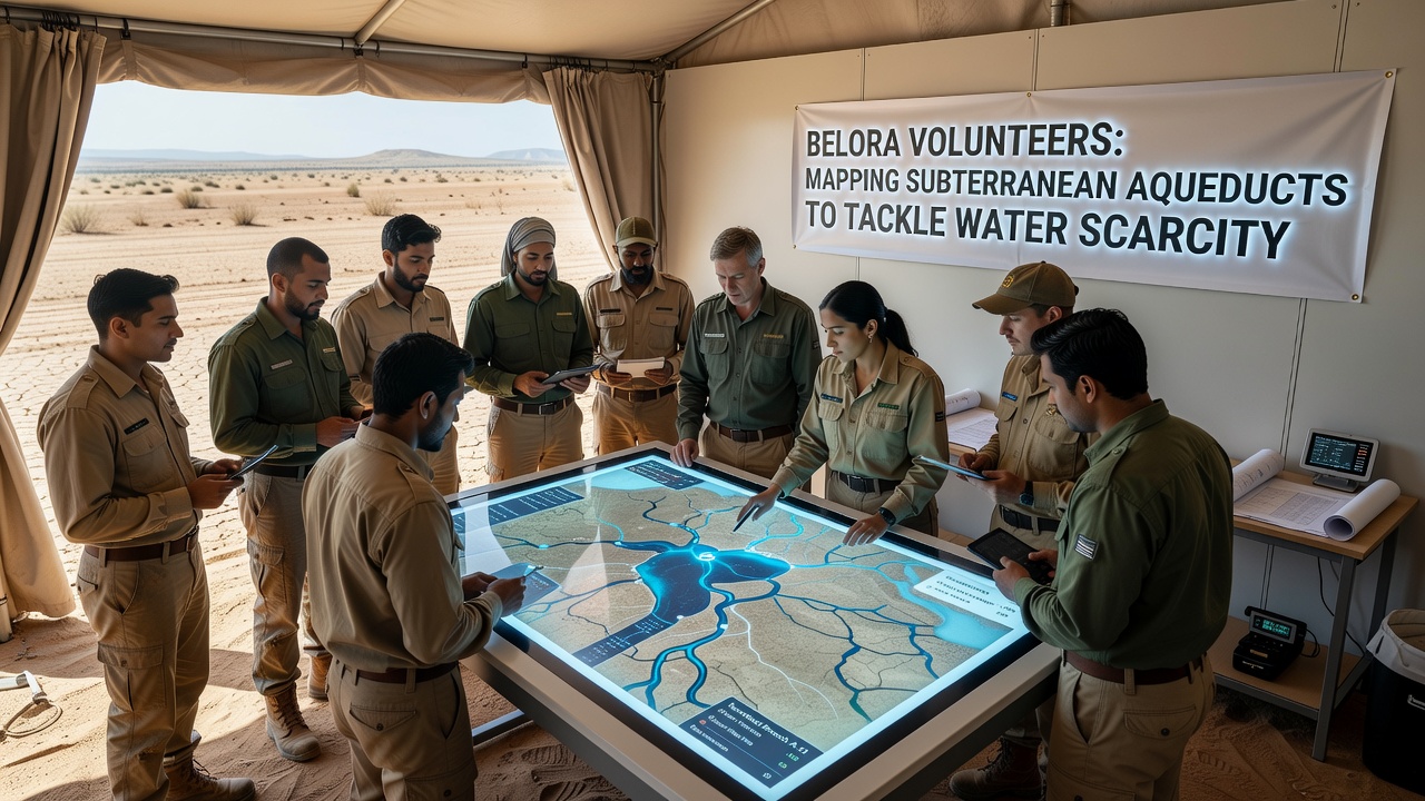
Software developed in partnership with a regional technical institute processes the incoming data and highlights areas where blockages or collapses may have occurred, and volunteers cross-reference these outputs against older land surveys to prioritize sites for further inspection. Training sessions emphasize safety measures because some passages contain unstable sections that require reinforced entry points before entry.
Connection to Current Water Management
Regional water authorities have begun reviewing the mapped data to assess whether restored segments of the aqueducts could supplement existing supplies during dry periods. Measurements taken during the 2025 drought season showed reduced reservoir levels across the area, and models project continued pressure on surface sources through the next decade. Planners note that gravity-fed channels could move water from higher catchment zones with minimal energy input, and early simulations indicate potential recovery of several thousand cubic meters per month once selected sections receive cleaning and reinforcement.
According to figures published by the European Environment Agency, southern European regions have experienced a 15 to 20 percent decline in average annual precipitation since 2000, and Belora lies within one of the zones flagged for increased monitoring. Separate research from the Natural Resources Canada groundwater studies has documented similar reuse of historic infrastructure in other Mediterranean climates, providing comparative benchmarks for the Belora teams.
Community Involvement and Training
Weekly meetings at the Belora cultural center allow volunteers to share findings and adjust mapping priorities based on new observations, and these gatherings also serve as forums for discussing how the data might integrate with municipal water plans. Local schools have incorporated basic lessons on the aqueduct project into geography classes, which has increased youth participation and expanded the pool of trained field assistants. Equipment donations from engineering firms have covered most hardware costs, while municipal grants support insurance and site access permits.
Conclusion
The mapping initiative continues to generate detailed records that link historical infrastructure with present-day resource needs, and ongoing work through late 2026 focuses on verifying the condition of additional branches. Municipal authorities plan to incorporate verified sections into updated water management frameworks once structural assessments conclude, and the volunteer database remains open for further contributions from trained participants. This approach demonstrates how community-collected spatial data can inform practical responses to water scarcity without relying solely on new construction projects.